Geography / Grades 3-4 / map practice
Find the five named oceans
Learning goal: Locate the Pacific, Atlantic, Indian, Arctic and Southern oceans using continent clues, then explain why the Pacific appears at both edges of a flat map.
Before you start: Distinguish land from water and find the named continents on a map. A helper may read the labels and directions aloud. North is at the top of the supplied maps.
Read or print this lesson What to practiceThe video could not load. The transcript is still available below.
Next: your worksheet
World Oceans: Follow the Land Clues
Checking sign-in...
Read the transcript
Saved reading place
Video transcript and practice. Reading or printing does not count as playback time or an assessed grade.
1. Five names, connected water
Video: 0:00
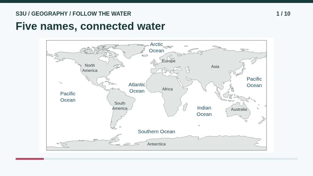
Imagine looking at Earth from far away. There is a lot of water! Today we will find five named oceans. They are not five separate swimming pools. They connect to form one global ocean. The names help us describe different regions. Continents are large areas of land. On our map, the land is gray and the ocean water is white. First we will learn with the names showing. Then we will hide them and try.
2. Read the land before the water
Video: 0:33
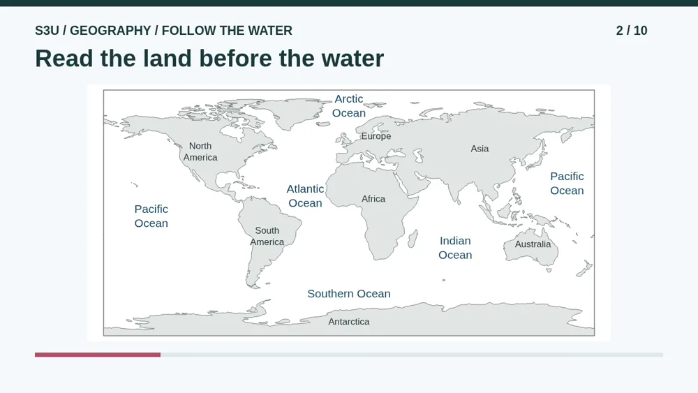
Here is our world map. North is at the top. Point to North America and South America on the left, then Europe, Africa, Asia, and Australia. Antarctica is along the bottom. A globe is round, but this picture is flat. This kind of map stretches sizes near the poles. Antarctica has not turned into a giant pancake! Do not use the picture to compare continent sizes. Small islands may be missing from this simplified map.
3. Atlantic: use both shores
Video: 1:08
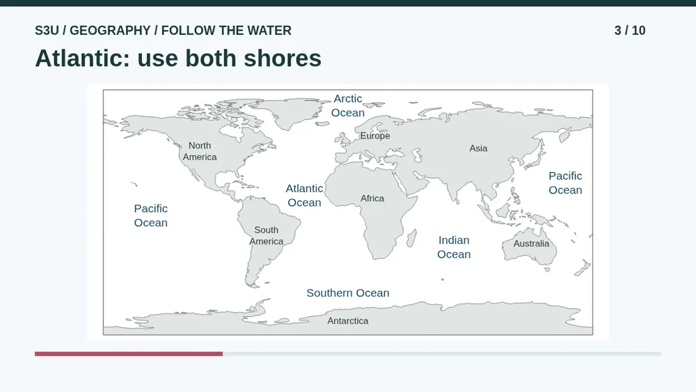
Let us work through one location. Find South America. Move your finger east, to the right, into the water. Keep going toward Africa. That water belongs to the Atlantic Ocean. Farther north, the Atlantic also lies between North America and Europe. Notice how we used land on both sides as clues. Say Atlantic, then explain where it is without saying just the middle of the screen.
4. Pacific: both edges, one ocean
Video: 1:39
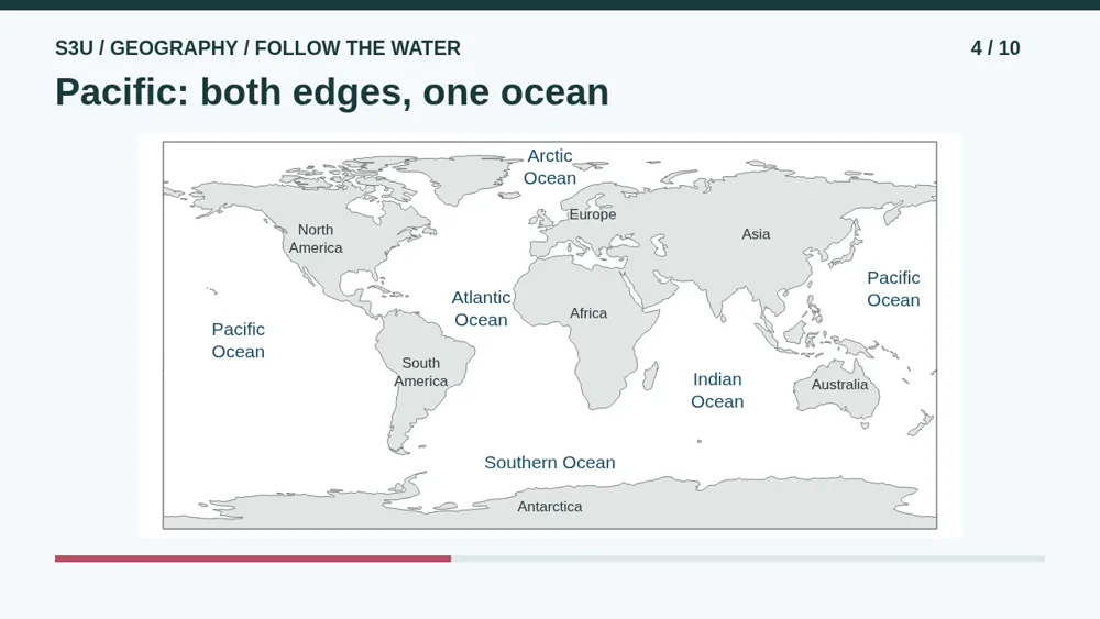
Find the Pacific Ocean west of the Americas, on the left. Now find its name east of Asia, on the right. Why is it written twice? This flat map has a cut through the Pacific. On a globe, the two edges meet. Both labels belong to the same ocean. No bonus ocean has sneaked in! Fun fact: one named ocean can appear at both edges of the same world map. Count different names, not how many times they are printed.
5. Indian: three land clues
Video: 2:12
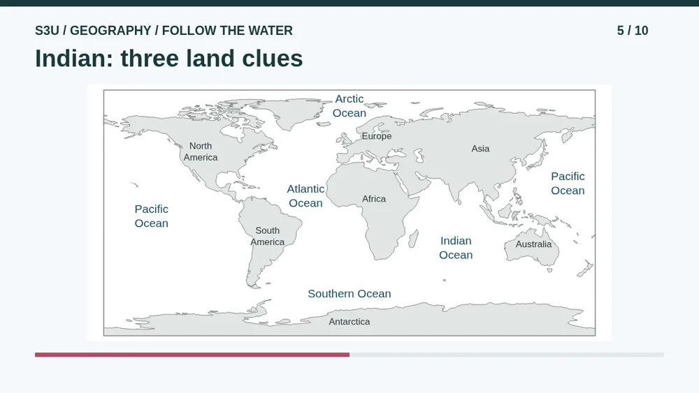
Find Africa again. Now look east into the water, below Asia and west of Australia. This is the Indian Ocean. Trace the three land clues with your finger: Africa, Asia, Australia. You do not need to memorize the exact spot where a word is printed. The word is a label, not a boundary around the ocean. If a map is turned or centered differently, those neighboring land clues will still help you.
6. Arctic north, Southern south
Video: 2:44
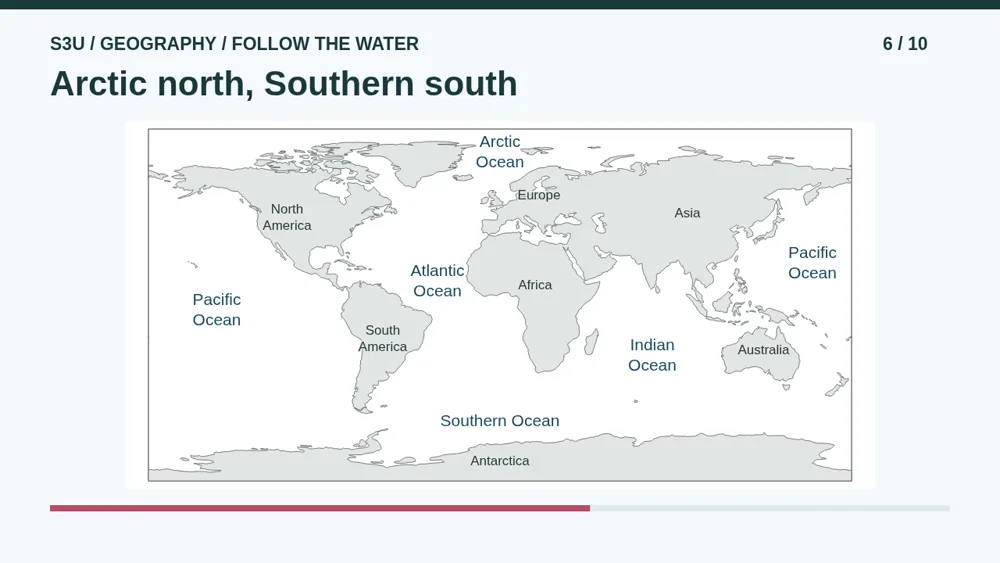
Look near the top for the Arctic Ocean. It is in the far north. Now look near the bottom for the Southern Ocean around Antarctica. Arctic and Antarctica sound a little alike, so check carefully. Antarctica is land in the south. Arctic Ocean is water in the north. The Southern Ocean surrounds Antarctica, even though our flat map shows that region as a strip. Ocean boundaries are naming conventions. Countries do not all use exactly the same boundaries.
7. A sea is not a continent
Video: 3:21
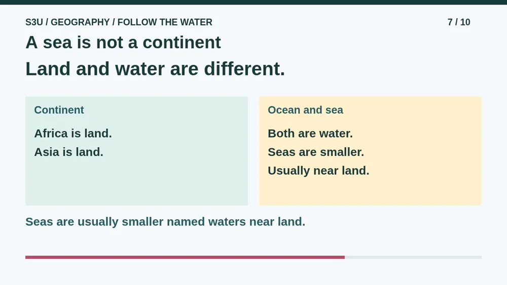
An ocean is not a continent. Africa and Asia are continents. Atlantic and Indian name oceans. You may also hear the word sea. Seas are smaller named waters, usually near land and partly enclosed by it. That is a usual pattern, not a rule without exceptions. For example, the Bering Sea is part of the Pacific Ocean. We are learning five ocean names, not saying there are only five named bodies of water on Earth.
8. Pause: name the lettered water
Video: 3:55
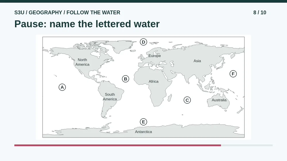
Pause here. The ocean names are hidden. Name the water at A, B, C, D, E, and F. Two letters need the same name. Use the nearby continents as clues. Then explain why the two matching letters do not mean two different oceans. You can say your answers to a helper or write them on paper. Do not look back at the named map until you have tried. Continue when you are ready to check.
9. Check with the continent clues
Video: 4:27
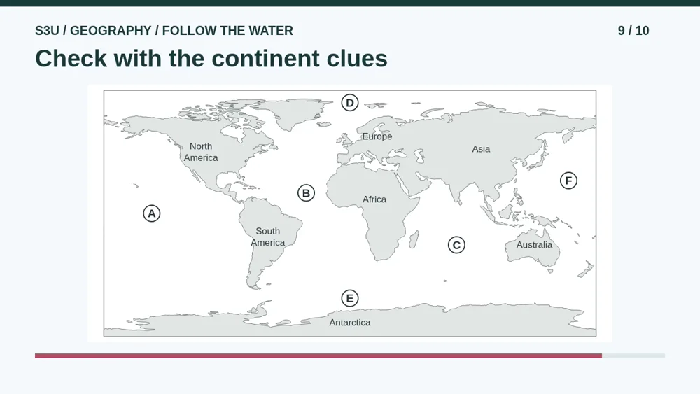
Here is the check. A is Pacific, west of the Americas. B is Atlantic, between the Americas and Europe and Africa. C is Indian, between Africa, Asia, and Australia. D is Arctic, in the far north. E is Southern, around Antarctica. F is Pacific, east of Asia. A and F share a name because this flat map cuts through the Pacific. If you mixed up two names, use their land clues to repair them, then try again with the names hidden.
10. Continue to your ocean worksheet
Video: 5:03
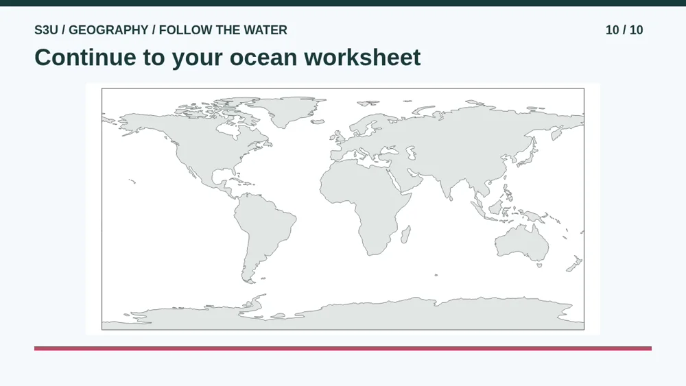
Continue to the worksheet below for more map practice. The first sheet asks about the lettered water. The second checks the map edges and the difference between land, oceans, and seas. There is also a blank map linked below this lesson. Try adding all five names yourself, with Pacific at both edges. Ask a helper to review your labeling and explanation. The checked questions do not automatically grade your drawing or handwritten map. Try the second sheet another day to see what you remember.
Show your understanding
You can point, explain aloud, draw or write.
- Locate five named oceans using surrounding continents and explain why two Pacific labels do not mean two different oceans.
- Distinguish continents, oceans and smaller seas; explain one limit of this flat map and try labeling an outline with a helper.
Try it yourself
Pause at the lettered map. Name A through F, explain the matching pair, then check with the continent clues.
Continue to the worksheet and try the second sheet another day. Use the blank map for labeling; a helper checks your handwritten names and explanation separately.
Next: your worksheet
World Oceans: Follow the Land Clueshttps://s3u.com/gl3o1
Labeled ocean map · Blank ocean map · Oceans, continents and map edges


Lesson: https://s3u.com/lessons/world-oceans